South Los Angeles population maps (1970 - 2016)
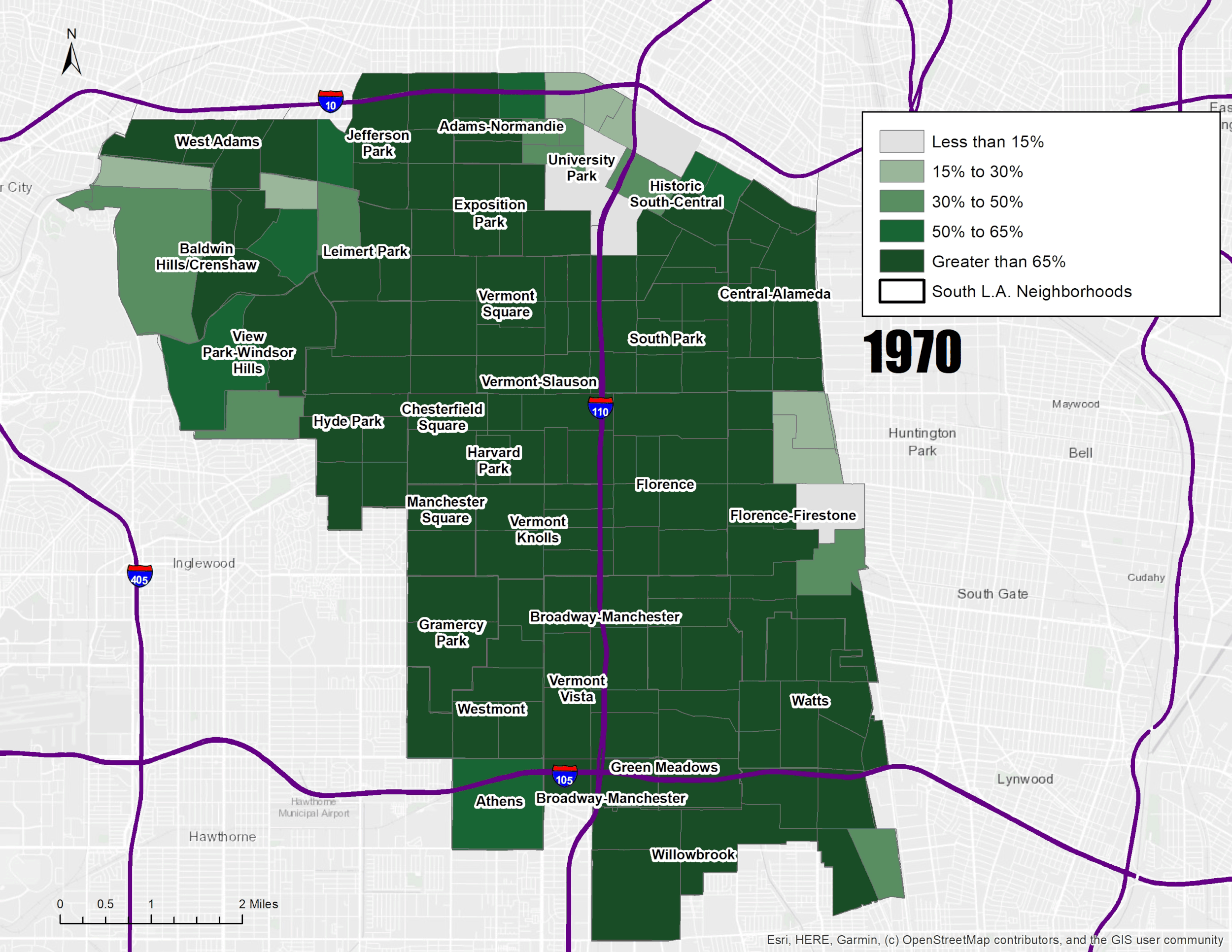
Black population in South LA

Latino population in South LA

A dot density map of the number of Central American-origin Latinos living in South L.A.
Data Charts featured in South Central Dreams

Figure 2.12. Population by Nativity and Years in the United States, South L.A., 1990, 2000, and 2012–16

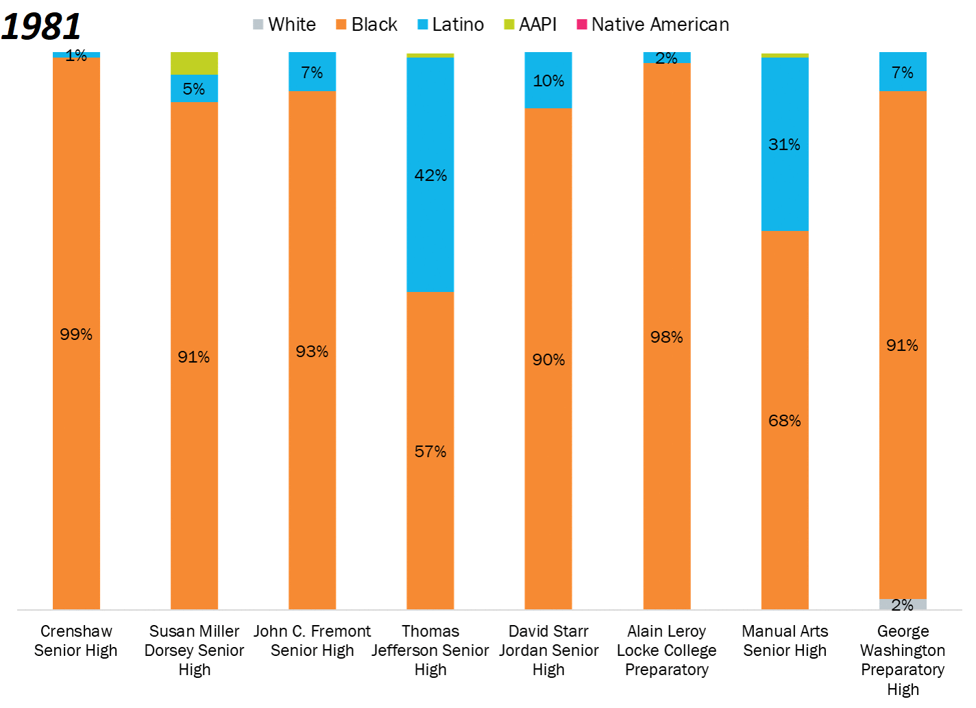
Figure 2.16. Demographic Composition of Schools in South LA, (a) 1981

Figure 2.16. Demographic Composition of Schools in South LA, (b) 2016

Figure 2.21. Working Poverty by Race/Ethnicity, South L.A., 2012–16

Figure 2.20. Black and Latino Unemployment Rates, South L.A., 1980–2016

Figure 2.3. Population Growth by Nativity, South L.A., 1980–2016

Figure 2.5. Demographic Change in South L.A. Overall and by Neighborhood, 1980–2016

Figure 6.1. Civic Engagement of Latinos as Share of the Total Population in South L.A. and L.A. County
Demographic composition of schools in South LA 1981 vs 2016